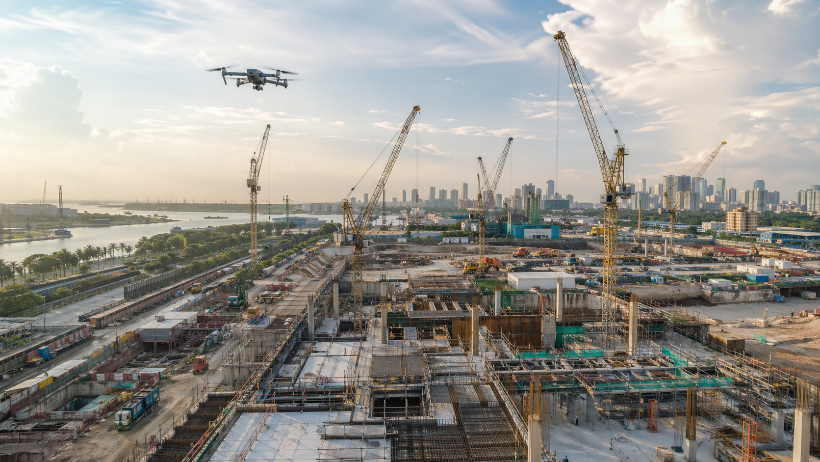
High-resolution aerial stills, overview imagery, progress flyovers and video clips for reporting, stakeholder updates and project communication.
Service overview
Photogrammetry and drone services from capture to usable project data.
Choose the workflow that best matches your site, your asset type and the deliverables your team needs, whether that is aerial photo, aerial video, mapping, modeling or structured project documentation.
CoverageDrone, close-range, ground-based and repeat-visit capture workflows.
OutputsAerial photo, aerial video, 3D models, inspection imagery, mapped views and site records.
FocusConstruction, infrastructure, industrial and asset documentation.
Drone Services & Photogrammetry
Aerial photo, aerial video, mapping and large-site drone capture planned for progress review, project communication and digital twin workflows.
3D Modeling & Digital Twin Creation
Transform overlapping images into 3D assets that make existing conditions easier to understand, share and revisit.
Survey & Mapping Support
Generate orthomosaic-style documentation and field context that support planners, engineers and geospatial teams.
Inspection & Asset Documentation
Document facades, roofs, structures and industrial elements where access is constrained and a visual record matters.
Construction Progress Monitoring
Set up recurring site capture for more consistent progress updates, milestone records and visual comparison over time.
Use Cases & Industry Applications
Detailed applications covering trench capture, facade inspection, agency documentation, URA IPAG-aligned workflows and construction progress records.
Customised Photogrammetry Training
Tailored aerial and ground-based photogrammetry mapping training for teams that want stronger operational, processing and QA capability in-house.
Deliverables
What a photogrammetry or drone engagement can produce.
Deliverables stay concrete so project teams can quickly understand what they may receive and how the output can be used after capture.
Orthomosaics, 3D textured models, mapped views and geometry-backed context for planning, coordination and presentation.
Repeat visits, organized image sets and visual evidence that make site understanding easier for owners, consultants, managers and contractors.
Services can also be scoped for ground-based trench capture, URA IPAG-aligned documentation and agency-facing reporting requirements.
Customised training can be provided for aerial and ground-based photogrammetry mapping, helping teams improve capture discipline, data handling, QA and deliverable readiness.
Field reality
Services anchored in live sites, not stock-style marketing.
The service mix covers aerial media, mapped capture, inspection documentation and ground-based records, but the common thread is the same: give project teams something clearer and more usable than scattered photos.
Aerial photo and video
Give stakeholders an immediate read on site condition, scale and change with visuals that are easy to present and easy to understand.
Site-wide mapped capture
Build orthomosaics, 3D context and repeatable aerial records for teams that need more than media alone.
Ground documentation
Extend the same capture discipline to trench records, close-range asset capture and staged works where aerial-only coverage is not enough.
Reporting and coordination
Package outputs so owners, consultants, contractors and agency stakeholders can review the same condition set with less ambiguity.
Drone deliverables
Drone services can support both media output and measurable data.
Some projects need clean aerial visuals, while others need orthomosaics, 3D reconstruction or repeatable progress records. The capture method is scoped around the end use instead of assuming every drone job is the same.
Aerial operations are supported by a CAAS Certified UA Operator credential, adding another trust signal for buyers who need more credible and controlled project delivery.
High-resolution drone stills for site overview, construction progress, asset context, project documentation and presentation-ready reporting.
Drone video capture for flythroughs, progress updates, stakeholder review clips and broader site communication across changing environments.
Overlapping aerial imagery processed into orthomosaics, textured 3D models and digital-twin-ready datasets for teams that need more than visuals alone.
Planned recurring capture for milestone comparison, site archive building and more consistent project visibility over time.
Engagement flow
A service structure that feels engineered, not improvised.
The workflow supports more than one-off drone flying by linking aerial photo, video, mapping and model outputs back to the project brief from the start.
Clarify the problem, the deliverable and the handover format before capture starts.
Select the best capture method for scale, access, geometry and review requirements.
Turn the image set into a clear, reviewable package matched to the original brief.
Share outputs with enough context that teams can act on them instead of deciphering them.
Related reading
Deeper pages for the service questions people actually search.
These supporting pages help explain the difference between aerial media and measured capture, trench documentation, agency-facing workflows and the role of digital twins in progress review.
Drone Photography vs Photogrammetry
Clarify when a project needs media only, and when it needs measurable outputs and 3D reconstruction.
Open pageTrench Capture With Photogrammetry
Explain how before-cover-up records can be made more useful than isolated field photos.
Open pageURA IPAG-Aligned Reality Capture
Outline how teams can scope documentation and deliverables for review-led workflows more clearly.
Open pageDigital Twins for Construction Monitoring
Connect recurring capture, aerial media and 3D review into a practical reporting workflow.
Open page
Service brief
Need help choosing the right capture workflow?
Send the site type, output needed and timeline here. This shorter form collects the key information first, then opens it in email or WhatsApp so you can move quickly.
Need a page that matches your exact service mix?
Workflows can be shaped further for sectors like heritage, marine, facade inspection or industrial plants while keeping the same measured, technical approach across aerial photo, aerial video and photogrammetry outputs.